

The Cyprus buffer zone is a haunting divide that separates this Mediterranean island between Greek and Turkish communities.
In 1974 the Turkish invasion of Cyprus left the island torn in two, as the Greek and the Turkish communities were divided and separated by the ‘Green Line’. The Turkish military occupied 40 per cent of the island, their goal being to keep Turkish Cypriots safe from the perceived threat of the Greek Cypriot government which had taken control of the island. Greeks in the path of the invasion fled, heading to safety in the south.
The United Nations set up a buffer zone to separate the two military forces, which ran along what was known as the green line, a divide that had previously been set up by the British colonial administration to stop inter-communal violence in the 1960s before Cyprus was granted independence. Green was the colour of the pen used by the British Commander to draw that line across the map. The Turkish military advanced as far as this line during their invasion, and this became the separation line.
The divide still separates the north from the south and runs for some 180 kilometres across the island. It even cuts straight through the middle of the capital city, Nicosia. In the south, the Republic of Cyprus is the internationally recognised state, and they see the north as being under the military occupation of Turkey. In the north though, a de facto government, the Turkish Republic of Northern Cyprus, declared itself as an independent nation, but the only country to acknowledge that is Turkey.
The security zone was established to stop further violence and a peacekeeping force has patrolled the land ever since to stop any clashes and further fighting. Things have calmed down a lot since the war. The borders were even reopened in 2003, allowing access for locals and travellers between the two states.
I decided to see this buffer zone for myself, so I travelled along it where I could. I saw a heavily militarised line of desolation that runs through Cyprus, an enduring legacy of the war that shook the island. If you’re as fascinated by geopolitics as I am, then keep reading, as I explain everything you need to know about the Cyprus Buffer Zone and how to visit it.
Table of Contents
What is the Cyprus Buffer Zone?
Before I start regaling you with stories of my journey along the Cyprus Buffer Zone, let’s take a look at what and where this diving line is.
The Cyprus Buffer Zone is a demilitarized area that acts as a partition between the Republic of Cyprus and the self-declared Turkish Republic of Northern Cyprus. Created in 1974 in the wake of military conflict, this stretch of land is monitored by the United Nations Peacekeeping Force in Cyprus (UNFICYP). The aim was to prevent further military engagement between the Republic of Cyprus, which is predominantly Greek Cypriot, and the Turkish Republic of Northern Cyprus, which declared itself as an independent entity but is recognised only by Turkey.
The buffer zone was not part of any premeditated plan but arose as a direct consequence of the volatile events of 1974, including a coup d’état in Cyprus aimed at union with Greece, and the subsequent invasion by Turkish forces. The United Nations intervened to maintain peace and stability, creating the buffer zone as a temporary measure. However, this ‘temporary’ zone has persisted for nearly half a century due to the lack of a comprehensive political solution to the Cyprus issue.
Spanning approximately 180 kilometres from east to west and varying in width, the buffer zone serves to minimise the risk of renewed hostilities between the Greek Cypriot and Turkish Cypriot communities. Within its confines are deserted villages, unused farmlands, and other structures frozen in time, many left in a state of disrepair since the 1970s.
Since its inception, UNFICYP has been responsible for patrolling the area and ensuring that it remains a neutral space devoid of military activity from either side. Despite its original intent as a zone to maintain a ceasefire, it has since evolved into a complex symbol of the island’s ongoing division and the international community’s struggles to facilitate a lasting peace.

Read more: 12 Things to Do in Northern Cyprus
Where is the Cyprus Buffer Zone?
The Cyprus Buffer Zone runs across the island of Cyprus from the eastern to the western coast, effectively dividing it into southern and northern regions. To the south is the Republic of Cyprus, internationally recognised as the sovereign entity governing the island, while to the north is the self-declared Turkish Republic of Northern Cyprus, which is recognised only by Turkey.
The buffer zone begins at the eastern town of Famagusta and stretches westward to the Morphou Bay area on the west coast. Along this route, it cuts through the island’s capital, Nicosia, dividing the city into Greek Cypriot and Turkish Cypriot sections. The width of the buffer zone varies considerably, from just a few metres in some urban areas to several kilometres in more rural regions.
This demilitarized area is overseen by the United Nations Peacekeeping Force in Cyprus (UNFICYP), which monitors its status and maintains its boundaries to prevent any military escalation between the two sides. For this reason, access is generally prohibited, and the border lines on either side are heavily guarded and monitored.

Read more: 12 Things to Do in Famagusta, Northern Cyprus
Is the Buffer Zone the same thing as the ‘Green Line’?
The terms ‘Cyprus Buffer Zone’ and ‘Green Line’ are often used interchangeably to describe the demilitarized area that separates the Republic of Cyprus from the Turkish Republic of Northern Cyprus. The name ‘Green Line’ originally comes from the line drawn on a map with a green pen by a British Army officer in 1963 to demarcate the boundary between the Greek and Turkish communities in Nicosia, during a period of inter-communal violence.
While the Green Line initially referred specifically to the division within Nicosia, its meaning has expanded over time to refer to the entire buffer zone that runs from the east to the west of the island. This zone was formally established in 1974 following a Turkish military intervention and is overseen by the United Nations Peacekeeping Force in Cyprus (UNFICYP).
Both terms point to the same geographical and political reality: a division that bisects the island and its capital, serving as a physical reminder of the ongoing conflict and separation between the Greek Cypriots and Turkish Cypriots. Although established as a temporary measure, this line has persisted for decades, solidifying into a long-term feature of the Cypriot landscape due to the lack of a lasting political resolution.

Read more: These Photos Will Inspire You To Rent A Car And Road Trip Northern Cyprus
Why is Cyprus divided?
Before you venture along the Cyprus Buffer Zone, you may well be wondering why Cyprus is even divided in the first place. Cyprus is divided due to a complex history of ethnic, political, and international factors. The island has two main ethnic communities: Greek Cypriots, who are the majority and are predominantly Christian, and Turkish Cypriots, who are the minority and are predominantly Muslim.
Here’s a brief history of the division between north and south, and Greek Cypriot and Turkish Cypriot communities:
- Colonial Rule: Cyprus was a British colony from 1878 until it gained independence in 1960. During colonial rule, the seeds of ethnic tension were sown as the colonial administration often employed a ‘divide and rule’ strategy.
- Independence and Constitution: Upon independence, Cyprus adopted a constitution that tried to balance power between the two communities. However, the constitution was deeply flawed and complicated, leading to discontent.
- Inter-Community Violence: Tensions escalated into violence in the 1960s, with both communities suffering. A United Nations peacekeeping force was deployed, and a green line was drawn through the capital, Nicosia, to separate the two groups.
- 1974 Crisis: A coup d’état backed by the Greek military junta aimed at unifying Cyprus with Greece prompted Turkey to intervene militarily, citing the need to protect the Turkish Cypriot community. Turkey took control of the northern third of the island, leading to a de facto partition.
- Establishment of Buffer Zone: The United Nations established the Cyprus buffer zone, or Green Line, following the Turkish intervention, with the aim of preventing further hostilities.
- Declaration of Northern Republic: In 1983, the Turkish Cypriots declared independence, forming the Turkish Republic of Northern Cyprus, which is recognised only by Turkey.
- Ongoing Division: Numerous attempts at reunification have been made, including talks brokered by the United Nations, but none have been successful thus far.
The division of Cyprus remains a contentious issue with geopolitical implications, involving not just the island itself but also Greece, Turkey, and, by extension, the European Union (the Republic of Cyprus is an EU member). Moreover, the division has had a profound impact on the daily lives and psyches of Cypriots on both sides of the divide, who have lived through generations of separation and uncertainty.

Read more: Why is Cyprus Divided? Everything You Need to Know.
My journey along the Cyprus Buffer Zone
After crossing the Ledra Street Border in Nicosia, Cyprus’ divided capital city, I hired a car in Girne and spent a few days exploring the beaches and ruins of Northern Cyprus. I then realised that if I really wanted to understand the divide between north and south, I’d need to see more of the Cyprus Buffer Zone itself. That’s when I decided to road trip along the northern side of the Green Line. Or at least, as much of the dividing line as I could.
Famagusta
I started in the east, in the city of Famagusta. This was once a thriving beach resort, but by the white sandy beaches I found the haunting remains of Varosha. Thousands of Greeks fled the city when the Turkish army advanced, leaving behind their homes and businesses.
The Turkish army then closed off an enormous section of the city that lies along the Cyprus buffer zone. Over the years, the holiday resorts and hotels have decayed, fallen down, and become wildly overgrown. Next to these war-torn remains, along one of the nicest beaches on the island, tourists still bathe in the waters and drink beer on the sands.
I followed the road away from the coast. The barricades and barbed wire extend into Famagusta itself, creating an impenetrable barrier that has completely isolated the old Greek settlement from the public.

Read more: Famagusta: How To Explore Cyprus’ War-Torn Holiday Resort
Nicosia
After Famagusta, I headed west into the interior of Cyprus. I took the road back to Nicosia, which is the world’s last divided capital city. Here you can stroll across the border at leisure, with only brief passport checks. On one side you can eat a Turkish kebab and on the other a Greek Gyros.
But the buffer zone still runs through here, and both sides are heavily fortified despite the relaxed border control. I could see UN troops looking out over the city from the middle of the security zone. They were relaxed, suggesting things weren’t quite so tense between both sides, but the Turkish and Greek soldiers on either side of the buffer zone were still on rigid lookout duty.

Ledra Street
The capital is an incredible place to witness the sudden change in culture, language, currency and religion that comes from simply strolling across the border. Nowhere else in Cyprus can you really see the contrasts and the similarities caused by the long divide between these two nations in such sudden detail.
The best place to see all this is on Ledra Street. Once Nicosia’s main thoroughfare, Ledra Street is now divided in two by the Buffer Zone. For years, the street was closed, but now that relations have cooled, you can now use the checkpoints here to walk over the border between north and south. It’s a simple border crossing, in fact, which hopefully goes someway to showing that reconciliation is possible, at least in the future.

Read more: The Ledra Street Crossing in Cyprus (Where It Is and How to Cross)
Denizli
From Nicosia, I then drove towards the western coast of Cyprus.
By the Mediterranean Sea, in the small town of Denizli, I found a war memorial to Turkish parachute regiments who fought in the war, alongside old bunkers, now sealed up, and unused, facing out towards sea.
I drove along the coast, towards the buffer zone, and then up into the mountains, where I found communities still living their lives right up to the border. Military signs and the odd guard post warned that the buffer zone was close, and the odd abandoned building showed that perhaps from here, people had fled, never to return.


Read more: The Ancient Ruins of Salamis, Northern Cyprus
Yesilirmak
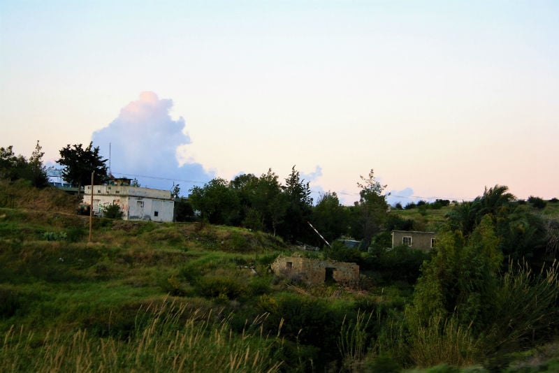
Further along, a few miles away from the coast and near the town of Yesilirmak, I found another military exclusion zone.
This was an old village, war-torn, derelict and abandoned. The war took its toll here, and the haunting ruins have never been reclaimed, simply fenced off by the military and left to rot. This was the starkest reminder, these abandoned homes, that the war divided, and continues to divide the people of Cyprus.
Along the buffer zone, I found communities which had been separated, literally divided in two by an almost arbitrary line which dictated where they could live and travel. Rather than being able to travel across the entirety of a single island, I had to follow the buffer zone instead, one side always out of reach.
The buffer zone may be a quieter affair now, and the border openings offer a huge glimmer of hope, but it may still be a long time before the two sides it separates manage to achieve a lasting peace and compromise that all can agree on. And until then, the unlucky villages, businesses, hotels and even airports which were caught in the middle by the green line, will continue to decay away, while at the same time the unlucky families and communities caught up in it all, will not be able to return to their homes.


Read more: Slow Travel: The Ferry From Turkey to Northern Cyprus
Can I safely visit the Cyprus Buffer Zone?
As you can see, I largely travelled alongside the Buffer Zone, as it’s difficult to actually visit the areas within the Buffer Zone itself. After all, it’s largely a military zone.
Portions of the Cyprus buffer zone are accessible to the public, too particularly in the capital city of Nicosia. There are now possibilities to visit Varosha on a guided tour, or I’m told, to gain access to Nicosia’s old international airport!
However, there are some caveats and guidelines to be aware of:
- Controlled Access: The United Nations Peacekeeping Force in Cyprus (UNFICYP) monitors the buffer zone, and certain areas are strictly off-limits to civilians due to safety concerns.
- Crossing Points: There are officially sanctioned crossing points between the Republic of Cyprus and the Turkish Republic of Northern Cyprus. The most frequently used one is located in Nicosia. To cross, you’ll need to show identification, such as a passport.
- Ledra Street: In Nicosia, the pedestrianised Ledra Street is one of the places where you can cross the buffer zone. The street is a lively commercial area on both sides, offering an interesting contrast between the Greek Cypriot and Turkish Cypriot communities.
- Tours: Some guided tours take visitors to specific points within or near the buffer zone, often including informative commentary about the history and politics of the Cyprus conflict.
- Abandoned Places: Within the buffer zone are various abandoned buildings and areas, some of which have been left untouched since the 1970s. While intriguing, many of these places are not safe for public access.
- Photography: Taking photographs within the buffer zone may be restricted. Always follow guidelines and instructions given by UN personnel or local authorities.
- Respect: The buffer zone is a sensitive area due to its political and military significance. Always respect instructions from UN personnel and be aware that the zone is a place with a serious purpose, not merely a tourist attraction.
- Ecological Sensitivity: The lack of human activity in much of the buffer zone has made it a haven for native flora and fauna. If visiting rural sections, take care not to disturb the local ecosystems.
If you’re interested in visiting, it’s advisable to research current conditions and rules, as they can change over time, and to respect all regulations put forth by UNFICYP and local authorities.
Read more: 11 Best Things to Do in Kyrenia (Girne), Northern Cyprus
FAQ: The Cyprus Buffer Zone
Here’s an FAQ on the Cyprus Buffer Zone:
Q1. What is the Cyprus Buffer Zone?
The Cyprus Buffer Zone is a demilitarized area that separates the Republic of Cyprus in the south from the self-declared Turkish Republic of Northern Cyprus in the north. It was established in 1974 to prevent further military conflict between the two communities.
Q2. Who controls the Cyprus Buffer Zone?
The United Nations Peacekeeping Force in Cyprus (UNFICYP) is responsible for monitoring and maintaining the buffer zone. It ensures that no military activity occurs in the area from either side.
Q3. Is the Cyprus Buffer Zone the same as the Green Line?
Yes, the terms are often used interchangeably. The name “Green Line” originally referred to a line drawn on a map to separate communities in Nicosia in 1963 but has come to signify the entire buffer zone.
Q4. Why was the buffer zone established?
The buffer zone was created following a coup d’état aimed at uniting Cyprus with Greece and a subsequent military intervention by Turkey in 1974. The zone was established to maintain a ceasefire and prevent further hostilities between Greek Cypriots and Turkish Cypriots.
Q5. Can I visit the buffer zone?
Yes, parts of the buffer zone are accessible to the public, especially in Nicosia. However, you must abide by guidelines set by UNFICYP and local authorities. Certain areas are off-limits due to safety concerns.
Q6. What documents do I need to cross the buffer zone?
You will generally need to show identification, such as a passport, to cross between the Republic of Cyprus and the Turkish Republic of Northern Cyprus at officially sanctioned crossing points.
Q7. Are there tours available?
Yes, guided tours are available that provide visitors with insights into the history and complexities of the Cyprus conflict. These tours often take you near or within the buffer zone.
Q8. Is photography allowed in the buffer zone?
Restrictions on photography may apply in the buffer zone. Always adhere to guidelines or instructions provided by UN personnel and local authorities.
Q9. Has the buffer zone affected local ecosystems?
Interestingly, the absence of human activity in many parts of the buffer zone has allowed native flora and fauna to flourish. While not its original purpose, the zone has inadvertently become an ecological refuge.
Q10. Are there ongoing talks to resolve the Cyprus conflict?
Negotiations facilitated by various parties, including the United Nations, have been ongoing for years. However, a comprehensive solution that would eliminate the need for the buffer zone has yet to be reached.
Q10. Is it safe to visit the buffer zone?
While parts of the buffer zone are open to the public, safety measures are in place, and UN personnel patrol the area. However, visitors should always be aware of their surroundings and heed any warnings or guidelines.
Richard Collett

Recent Comments