

The Langtang Trek is Nepal’s most underrated trekking route. Step aside, Everest Base Camp, and move over Annapurna Circuit, because despite being severely damaged during the 2015 earthquakes that rocked the country, the Langtang Valley is very much open for hiking, and compared to Nepal’s more popular treks, there will barely be another soul in sight!
The Langtang Valley straddles the border with Tibet and China in the heart of the Himalayas. A rough days bus ride to the north of Kathmandu will bring you to the start point, from where you’ll spend the next week hiking up and down the valley.
It’s not the hardest trek in the world, but the altitude and weather will still be testing. You’ll walk to over 4000 metres, meet the resilient locals who call the Langtang Valley home, and enjoy what could be one of the most beautiful valleys in Nepal.
This is my guide to the Langtang Trek!


Table of Contents
A Brief History of the Langtang Valley
The Langtang Valley is currently a part of Nepal that is in recovery. The 2015 earthquake hit the valley hard. Entire villages were wiped off the map by avalanches and landslides, and hundreds of people were killed.
Recovery has been difficult, but it’s assuredly been positive, and now the villages are being rebuilt, hotels restored and hikers welcomed back again. The valley was hard hit, but this won’t have been the first natural disaster to take place here, and you’ll quickly find that the Tamang people who live here – and who are closely related in ethnicity, culture and language to Tibetans – are incredibly resilient.
The Langtang Valley has traditionally been a very isolated part of Nepal, and it’s very, very different to Kathmandu where you’ll be arriving from! Tibetan Buddhism is the predominant language, and historically, the people here have had closer ties to Tibet than to Nepal.
The Langtang National Park was established in the 1970s to protect this area of spectacular nature and unique culture, and to develop sustainable tourism in the region.

Where is the Langtang Valley?
The Langtang Valley is found to the north of Nepal, in the Langtang Region which forms the border with China.
This is the Himalayas, and within the Langtang Region, you can find some of the world’s tallest mountains, with the highest being Langtang Ri, a peak which stands at 7234 metres. Across the border, you can find even higher mountains in Tibet, including Shishapangma, which at 8027 metres tall is the world’s fourteenth tallest peak.
The Langtang Trek takes place entirely within the Langtang National Park, with the trek generally beginning and ending in the village of Syabru Besi, which is found at an altitude of 1400 metres. Most hikers will trek as far as the village of Kyanjin Gompa, which lies at an altitude of 3800 metres, with the peak of Kyanjin Ri at 4800 metres being the highest that trekkers will get to without special equipment and permissions.

The Best Time of Year to Trek the Langtang Valley
I went trekking in Langtang at the start of June, and while the weather was, for the most part, great, there were a few thunderstorms along the way. June is actually the start of the monsoon season, which generally runs until September. You can get heavy rains and later on in the season, road closures and even landslides, so it’s not a recommended time to visit.
The best time to visit is from September through to November, when the weather is dry and it’s not too cold yet. In winter, it will be bitterly cold at altitude, and there will be heavy snowfall. You can hike again in the spring though, from March through to June, and before the monsoon arrives again!

How to travel to Syabru Besi and the Langtang Valley
Syabru Besi is the hub for the Langtang Valley, where you can find hotels and pick up any last-minute supplies before you begin the trek. It’s a small town, but there are direct bus connections to Kathmandu.
From Kathmandu to Syabru Besi, the distance is a mere 120 kilometres. Don’t be fooled though, because, from the capital, it’s going to take you at least 9 hours to drive the whole way, possibly even longer!
You’ll soon realise why, because the paved road from Kathmandu, heading north towards China, quickly deteriorates into an unpaved nightmare. It gets dusty, so bring something to cover your face and to cover any camera equipment you might have too.
If it rains, it gets muddy, and the road can close. There can be landslides and rockfalls while there are a surprising number of heavy-duty trucks using the road, despite its terrible quality, and that causes blockages and delays. At times, you might need to get out and help push, while at other times, you’ll look out the window and find yourself peering over a never-ending precipice. On the return journey, the bus I was in took a completely different route, as the shorter road was closed due to the weather. The longer route took us around 11 hours of driving.
It’s a real journey, and a real adventure and this is before you even start the trek!
The public bus will cost around 600 rupees each way, per person, for the most basic option, with no air conditioning and little room to move. In Kathmandu, these depart early morning from the Maccha Pokhari Bus Station. You can take a taxi here from the Thamel district for a few hundred rupees, depending on your haggling skills. There are also air-conditioned buses which cost around 1000 rupees and give you much more comfort. Syabru Besi is so small that you won’t have trouble finding the bus station here!
If you book a trekking tour package, then transport may well be provided by the company.

The Langtang Trek – The Route
From Syabru Besi, I spent 6 days trekking to Kyanjin Gompa and back again. 3 days hiking up, 1 day at the top, and 2 days hiking down again. You can do it quicker if you are accustomed to the altitude, but 5 days is the recommended time. If you have more days though, then are plenty of teahouses on the route where you can relax for longer on the way up too. You’ll also need 2 days just getting to Syabru Besi and back from Kathmandu, meaning you’ll need a total of at least 8 days to spend in Langtang National Park.
If you’re planning on trekking in Langtang, then here’s the day to day itinerary I embarked on (including travel days from Kathmandu).
Day 1: Kathmandu to Syabru Besi
The first day is a long day. I departed Kathmandu around 8 am and arrived into Syabru Besi at around 5 pm. That’s 9 hours on the road, and it’s a bumpy, dusty and dangerous road. It’s a challenging start, but nothing good is ever easy, and it’s well worth the long ride!
I spent the night in Syabru Besi, and there are plenty of guesthouses on the main street (indeed, there’s only really one street in the town!). If you have time, then you can visit the nearby hot springs, or simply get settled in, have dinner at your guesthouse and wait to start the trek the next morning.
Syabru Besi is at an altitude of 1400 metres.

Day 2: Syabru Besi to Lama Hotel
10 kilometres, approx 1000 metres altitude gained
The first day of hiking took me from Syabru Besi to Lama Hotel, a distance of 10 kilometres. Follow the signs out of Syabru Besi, cross over the river and walk through the fields of marijuana (yes, you read that correctly, it grows wild on the way up!). You’ll now be walking up into the Langtang Valley.
My first stop was a few kilometres in at Domen, where I enjoyed a tea break. The lunch break was at Bamboo. This first section isn’t too difficult, as it’s only a gentle upward climb.
The second half of the day is much tougher, as you’ll be ascending several hundred metres over a short distance. It’s very uphill, and you can end the day at Lama Hotel (actually a village!) where there are several guesthouses. I personally stayed at Friendly Guesthouse.
This first day of hiking, I became very ill, halfway through the day. I think because of the food I’d eaten the previous day, and I can say, although the views were beautiful, it was horrible going for me when I was throwing up every few metres on the ascent!
From Syabru Besi to Lama Hotel, you’ll find that the valley is mostly sheltered and covered in forest.
Lama Hotel is at an altitude of 2500 metres.

Day 3: Lama Hotel to Langtang Village
12 kilometres, approx 900 metres altitude gained
Day 3 of the itinerary and your second day of trekking Langtang will see you hiking up to 3400 metres, and gaining a further 900 metres elevation. If you’re from sea level like I am, then around about now you’ll probably start to feel the altitude kicking in.
It may not sound too high, and compared to say the Everest Base Camp Trek, it’s really not, but if you’re not used to the elevation then it can hit you, so be prepared for things to start getting difficult.
Today, you’ll pass from the forested areas into the open valley, where trees struggle to grow higher up the mountain slopes. You’ll also really begin to see the devastation caused by the 2015 earthquake, as Langtang Village was the most hard-hit part of the valley.
Before you reach Langtang Village, you’ll pass through an abandoned village. It’s totally deserted, and you’ll see huge boulders sticking out of old houses. As you reach Langtang Village itself, you’ll see a memorial. This is dedicated to the victims who were lost in the avalanche that wiped out the village. The buildings you see now are all totally new, as everything here was flattened. It’s harrowing of course, but it’s moving to see how the recovery process is ongoing.
Langtang Village is at an altitude of 3400 metres.
Day 4: Langtang Village to Kyanjin Gompa
7 kilometres, approx 400 metres altitude gained
Day 4, and your third day of hiking will take you to 3800 metres, to the village of Kyanjin Gompa. This will be a shorter hike in terms of both distance and elevation, but you’ll of course be at an increasingly high altitude, and things will be tougher.
Today you’ll really begin to appreciate the surroundings, as the valley opens up further and ahead of you in the distance, you’ll see the high mountains, some of which rise to 7000 metres. You’ll pass snow-capped peaks and glaciers, and the weather can begin to get incredibly unpredictable, with rain and fog appearing out of nowhere.
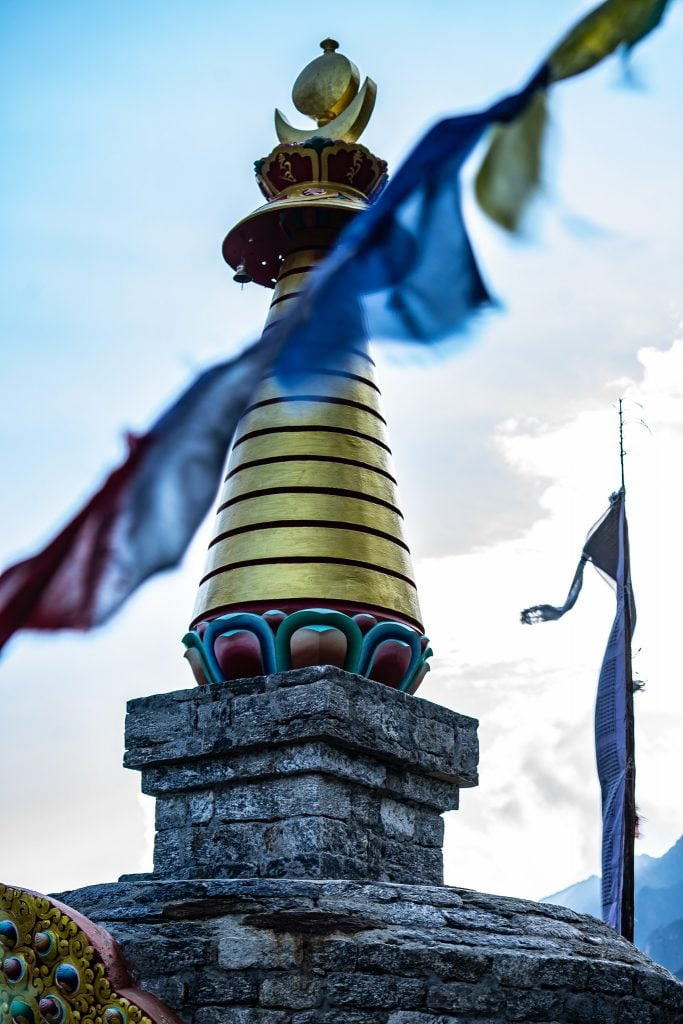
You’ll likely have most of the afternoon left if you set out from Langtang Village early, so I’d recommend visiting the local Yak Cheese Production Centre in Kyanjin Gompa, where you can try some locally produced yak cheese. If you’re feeling energetic, you can also hike further along the valley, or head up to one of the lower stupas, for views over the village. Take the time to get used to the altitude though.
Kyanjin Gompa is at an altitude of 3800 metres.

Day 5: Kyanjin Gompa to Kyanjin Ri (Half Day Hike)
4 kilometres return, max 1000 metres altitude gained
Kyanjin Gompa makes for a great base to explore the surrounding area, and if you have extra time, this is a good spot to spend an extra night or two. On Day 5, I personally attempted the hike up to Kyanjin Ri, a nearby mountain peak. Supposedly it sits at an altitude 4600 metres, but the signs at the top actually say 4800 metres or thereabouts. Not that I actually made it to the summit!
The first part of the trail leads you straight up from the village to Little Kyanjin Ri, which is found at 4300 metres. There’s an epic lookout point here, and you can see the mountain peaks and the glacier.
From Little Kyanjin Ri, it’s another 1 kilometre of uphill walking to the actual summit. By this point, the altitude was starting to hit me, and my hands were swollen massively. They looked giant! The weather also began obscuring the summit, so I decided to turn back after hitting around 4500 metres in altitude, and to enjoy the view from where I was rather than struggling upwards!
It’s a short, sharp and steep uphill hike to Kyanjin Ri, which will probably take around half a day.
Kyanjin Ri is at an altitude of approx 4800 metres.

Day 6: Kyanjin Gompa to Lama Hotel
18 kilometres downhill
After a second night spent at 3800 metres, it was time to head back down again. The first day, I trekked 18 kilometres downhill, to spend the night in Lama Hotel, where I’d spent the first night of the trek proper at the start.
On the way down, it’s easy-going, and I really began to appreciate the lower altitude again!

Day 7: Lama Hotel to Syabru Besi
10 kilometres downhill
If you’re really in a rush, and you get an early enough start, then you could hike down from Kyanjin Gompa to Syabru Besi in a day. I’m told that’s what the locals do anyway!
If you’re not in a rush, then after spending the night at Lama Hotel, take a leisurely stroll back to Syabru Besi, a distance of 10 kilometres. Once you’re back in the town, you’re best spending the night here and catching an early bus back to Kathmandu the next day.

Day 8: Syabru Besi to Kathmandu
With the Langtang trek complete, there’s just one last stage of the journey left, the return to Kathmandu.
Again, this is a long and rocky ride, and after the trek, you might be aching a bit more when you hit the bumps!

Accommodation and Food on the Langtang Valley Trek
The Langtang Valley Trek is great because there are teahouses all along the route. You’ll never go more than an hour without seeing one!
The Nepalese Teahouse is a standard along trekking routes in the country, and you’ll find they are both guesthouses, restaurants and shops. You can stay the night, you can stop for hot tea, for lunch, or snacks and you can stock up on water.
As on most trekking routes in Nepal, if you stay the night at a teahouse, it’s expected that you also eat dinner there. Most teahouses will only charge around 100 rupees per person for a bed (which is 1 USD!!) but the rule is you then eat there. Meals in the Langtang Valley are almost exclusively vegetarian, apart from at the start of the trek in Syabru Besi. You can expect to pay between 500 -1000 rupees per dish in the valley, with prices increasing as you get higher.
While water in Syabru Besi cost 100 rupees, in Kyanjin Ri, at the top it can be sold for 300 rupees – and at altitude, you need to keep drinking water constantly to stay hydrated too! The same goes for everything else. Beers get more expensive, as do basic food items. Everything at the top has to be carried up by either porter or by donkeys, so it’s no surprise things cost more!
Ordinarily, you can pay for boiled water to save a few rupees, rather than buying more expensive bottled water all the time.
Many of the teahouses are completely new, having been rebuilt in the wake of the earthquake, but most will have just basic facilities. You can expect squat toilets and cold showers. Some teahouses will offer hot showers for extra. Ask for extra blankets if you haven’t taken a sleeping bag, as it can get cold at higher altitudes of course.
Electricity is also limited when you are trekking Langtang, so invest in a Power Bank if you haven’t already. You can charge phones and camera batteries at some teahouses, but they will charge you extra for this – usually around 300 rupees.
A few spots in the valley have mobile data connection, and in Kyanjin Gompa a few of the teahouses could even sell you use of wifi, but at around 1000 rupees for 500 MB. Be prepared to be disconnected for the trek, once you leave Syabru Besi.
It goes without saying that there are no cash machines anyway! Make sure you take out enough rupees in Kathmandu to pay for EVERYTHING! Paying 500 rupees per meal, 3 times a day, adds up over a week.

Do I Need a Guide and Porter?
Guides and porters aren’t a requirement on the Langtang Valley Trek. The trail is well marked – in fact for most of the valley, there is just one path anyway! – and it’s even on Maps.me (download this awesome app before you start!).
You can hire guides and porters though, either in advance through companies based in Kathmandu, or even just on the ground in Syabru Besi. If you do, you’ll be helping out the local economy immensely, especially in the wake of the earthquake, as tourism dropped drastically and visitor numbers are still incredibly low.
The porters will take the load off your back, literally! This was the first time I’d ever trekked with a porter, and although I felt guilty about these guys lugging my gear up the valley, I truly did appreciate being able to hike with just a small daypack. It felt like cheating at first, but it was liberating too.

What Equipment Do I Need for the Langtang Valley?
Travel light of course. You don’t want too much on your back. If you are hiring a porter, make sure you can put your gear in a suitable rucksack for them to carry, and keep the weight as low as possible.
You’ll need basic trekking equipment, with a few changes of clothing, good shoes and a good backpack to take the weight off your shoulders. It’s really up to you how much you think you need, but I’d recommend ensuring that you have a warm hoodie, a waterproof coat, a sun hat, suncream and a face scarf or buff. That’s a minimum. You’ll also want a water bottle, a few snacks and plenty of spare socks! If you get cold at night, you might want a sleeping bag, but to be honest, most teahouses can give you blankets.
Take a camera too, because the views are outrageous!
If you need to pick up any trekking gear last minute, then head to the outdoor shops in Thamel, in Kathmandu, where you can get almost anything. The prices are usually great, and you can find brands like North Face or Osprey everywhere (even the fakes are great quality)!

Fees and Permits
To access Langtang National Park, foreign visitors have to pay a 3000 rupee entry fee at the checkpoints. These are actually on the main roads into Syabru Besi, and you’ll need to show your passport, so make sure you pack this.
In addition to the national park entrance fee, you also need to purchase a Local Area Permit (you used to need a TIMS) which has to be purchased in Kathmandu, at the Tourist Information Office.
I would estimate, that if you are hiking unguided and without a porter that you’re likely to spend around 3000 rupees per day, on average (around 30 USD), for food, water, accommodation, transport and permits etc.

All Words and Photos by Richard Collett
Disclaimer: The Langtang Valley Trek was provided by the Nepal Tourism Board, as part of HTM 2019, however, all opinions expressed in this article are, as always, my own!

beautiful trekking and complete information.