
Discover the unusual story of Jordan’s ‘panhandle’, a cartographical curiosity in the far eastern desert borderlands between Syria, Iraq and Saudi Arabia.
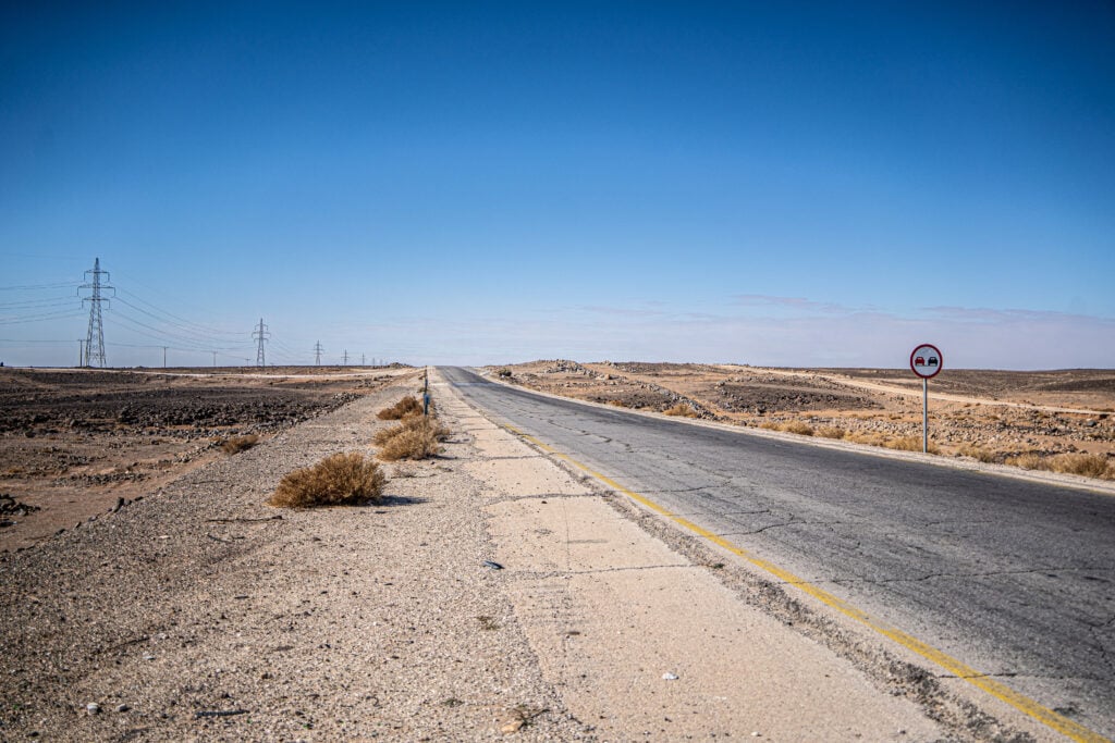
The empty highway led northeast from Azraq. Leaving behind the sparse palms and military compounds of this desert outpost, pressing deeper into the basalt-covered plains, it felt as if the road itself was trying to escape Jordan. There were no diversions, the topography was sparse and flat, and the unbending strip of tarmac headed towards a vanishing point far on the horizon.
This was the route we took to Ruwaished — the most easterly town in Jordan, and arguably its most remote. It lies close to where Jordan brushes up against Iraq and Saudi Arabia in a contested corner of the desert that barely registers on most maps. Along the way, we passed through one of the more curious features of modern cartography: a slender tongue of land stretching eastward — a kind of Jordanian panhandle — poking awkwardly between its neighbours.
It’s not marked as anything special. But once you look at the map, the shape becomes unmistakable: a long projection of Jordanian territory running towards the Iraqi border, Syria to the north and Saudi Arabia to the south. Seemingly carved with deliberate intent, I wanted to know why this ‘panhandle’ of land existed in these empty landscapes.
Watch the video here:
Taking the desert highway east into Jordan’s panhandle
Our journey began in Azraq, a small town known less for itself than for what surrounds it. The famed Azraq Wetland Reserve lies just to the south, a fragile remnant of what was once a vital desert oasis. In Roman times, this was an important staging post, and later, during the First World War, Azraq’s basalt castle became a strategic base for T.E. Lawrence and the Arab Revolt.
We followed the road northeast, joining Highway 5, a desert road leading to Highway 10 (otherwise known as the Baghdad International Highway), which then cuts dead east to the Iraqi border, some 200 kilometres from Azraq. These are roads that seemingly begin nowhere and end somewhere else entirely — a corridor to a little-visited frontier.
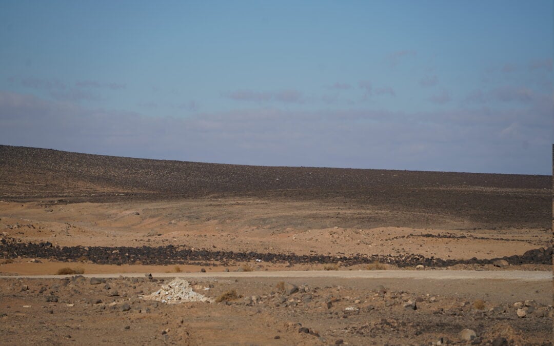
At first, the landscape was familiar: long stretches of basalt-strewn terrain, remnants of ancient lava flows that give the region its stark, almost lunar character. Bedouin camps, water tankers, herds of goats; then nothing. The desert widened. The sky grew larger. And gradually, even the idea of a destination began to feel speculative.
About an hour outside Azraq, as we passed a final police checkpoint at a lonely roundabout outside a sparsely populated settlement and turned east. The road descended slightly into flatter terrain, but more importantly, the cartographical layout began to shift. We had entered a narrow eastern corridor of Jordan, bounded by Syria to the north, Saudi Arabia to the south and Iraq to the east. It felt like we were driving through a geographic funnel — as if the land itself was being squeezed into a diplomatic compromise.
On a map, this area looks like a mistake: a long eastern protrusion that juts out from Jordan’s main body, stretching almost 100 kilometres eastward before terminating at the Karameh Border Crossing with Iraq. A border crossing that was besieged by ISIS in 2014 during the terror group’s attempts to take control of Iraq. For years, the crossing remained largely closed, open only to those brave truckers willing to risk their lives running freight through ISIS territory.
The border was still closed to us, given we were driving a Jordanian hire car and didn’t have Iraqi visas. However, I wanted to explore what, in geographical terms, is called the ‘panhandle’ — a narrow extension of territory, often a legacy of outdated treaties or misunderstood negotiations — and so we pressed eastwards.

Read more: Winston’s Hiccup: How a Cartographical Mishap Defined the Jordanian-Saudi Arabian Border
Why does the Jordan Panhandle exist?
The answer, predictably, lies in colonial paperwork. When the Ottoman Empire collapsed after the First World War, the British and French divided its Arab provinces into new political units — Syria and Lebanon under French control; Iraq, Palestine and Transjordan under British oversight.
At the time, Transjordan was not a fully-fledged state but a British protectorate — a holding ground for Hashemite rule east of the Jordan River. Its borders, especially in the east, were fluid and undefined. Meanwhile, Iraq, also under British mandate, needed a secure overland route westwards, linking Baghdad to Amman and, ultimately, the Mediterranean.
The highway corridor — now part of Jordan’s panhandle — was created to provide exactly that. It allowed movement between Iraq and the wider British imperial sphere, especially vital in the early days of oil transport and military logistics. More than that, the corridor acted as a buffer zone, separating Saudi tribal territory from the Baghdad-Amman road, at a time when Ibn Saud’s expansionist ambitions were unsettling British planners.
The modern borders we drove between were not drawn in sand but negotiated in meeting rooms — in Cairo, London, and Geneva — often by people who had never set foot in this part of the world. What remains is a legacy of those decisions: a panhandle born not of geography, but of geopolitics.
Although the route we travelled lacks conventional tourist attractions, its location alone makes it a compelling stop for travellers interested in borders, overlooked regions, or the geopolitical history of the Middle East. In the 1950s, Jordan and Iraq briefly formed a political union — the Arab Federation — which made this corridor symbolically significant, though the arrangement dissolved within a year. The area has also played host to refugee populations, with a now-closed camp once among the largest for Syrians in the country.
From inside the car, this political history was invisible — but the land told its own story. The road was arrow-straight, flanked on either side by emptiness. Occasionally, we passed military posts and security checkpoints. At one point, a pair of Jordanian police waved us down, checked our documents, and asked where we were heading.
“Ruwaished,” we said.
They raised their eyebrows but waved us on.
You don’t come out here unless you have a reason. For most people, the road is a route to Iraq — for trade, for transport, or, historically, for pilgrimage. For us, it was a journey into spatial abstraction, a geopolitical oddity, the chance to see a cartographical curiosity on the ground itself.
Read more: The King’s Highway: Driving the World’s Oldest Road
Ruwaished: The town at the end
Eventually, two hours after setting off from Azraq, we arrived in Ruwaished, the last town in eastern Jordan. The buildings are low and scattered, a mix of concrete housing, police stations, and small shops. Trucks were parked up at checkpoints or petrol stations, awaiting paperwork. Military vehicles patrolled the potholed road.
Ruwaished is a border town without a border crossing. The actual Iraq–Jordan checkpoint lies further east, beyond the limits of our journey. But this is where people live who deal with the reality of borders every day — customs officials, logistics workers, army officers, and their families.
We stopped for lunch at a surprisingly grand truck stop. A palatial building with Corinthian columns outside, and a small fleet of Jordanian and Iraqi-plated lorries waiting in the wide car park. Inside, truck drivers were feasting on dolma, biyriani, fried chicken and curries. The last refreshment stop before you hit Iraq.
Most people pass through Ruwaished on their way to somewhere else. Few stop. Fewer still come just to see the town. But I found something arresting in its stillness. It felt like a frontier — not in the dramatic, Wild West sense — but in the quieter, more bureaucratic way that modern frontiers function. Documents, waiting, absence. Ruwaished isn’t romantic, but it is real.
Standing outside the café, watching the highway disappear eastward, I thought again about the shape of this land. The panhandle — this corridor to the Iraqi border — remains important. Not only for Jordan’s economy, which depends on trade with Iraq, but also as a symbolic assertion of presence.
To have a road is to have a stake. To maintain it is to remain visible. This long, narrow reach of territory is as much about sovereignty as it is about logistics. In recent decades, the area has also taken on new strategic significance. During the U.S.-led war in Iraq, the highway was a vital supply route. Today, it is closely monitored for security threats. The rise of ISIS closed the border for long stretches of time in recent years. The presence of the panhandle allows Jordan to control access, to manage the space between states — something as valuable now as it was a century ago.
On the drive back, the sun dipped low behind us, casting long shadows across the desert floor. The road felt even straighter in reverse. Ruwaished disappeared in the rear-view mirror almost as quickly as it had arrived.
We passed again through that silent panhandle — still nameless, still shapeless on the ground, yet rich with meaning. It exists not because of natural law, but because of negotiated interests, drawn with rulers and agreed upon with handshakes. Its function has shifted over time — from trade corridor, to military route, to security zone — but it persists, as borders often do, long after the reasons for their creation have changed.

Read more: The Hejaz Railway: A Plan to Unite the Middle East by Train
How to visit Jordan’s ‘Panhandle’
Travelling through Jordan’s far eastern panhandle, from Azraq to Ruwaished, is one of the more unusual overland journeys in the region. It crosses some of the country’s most remote desert terrain and ends at a little-visited border town perched just west of Iraq. The road is paved and surprisingly straightforward, but the geography, history and atmosphere along the way are anything but.
Starting from Amman, you’ll follow Highway 40 eastwards through Zarqa and into the desert. After around two hours and 125 kilometres (with stops at the Desert Castles en route), you’ll reach Azraq — a town with ancient roots, a dwindling oasis and a strategic past. Azraq is also the point where the landscape begins to change dramatically. From here, Highway 5 leads further northeast into the basalt-strewn plains of Jordan’s Eastern Desert. The road eventually merges with the so-called Baghdad International Highway, a long, straight artery of tarmac stretching to the Iraqi border.
The stretch from Azraq to Ruwaished takes around three hours by car and passes through Jordan’s eastern corridor — a narrow extension of territory known informally as the panhandle. Despite the strategic significance of the route, the infrastructure is minimal. The road itself is surfaced and drivable in a standard car, but conditions vary. Potholes are frequent and the shoulders can be soft or crumbling. Petrol stations become rarer the further east you go, so topping up in Azraq is essential. It’s also wise to bring extra water, food, and a charged phone with offline maps. While GPS coverage is generally reliable, mobile signal can drop out across longer stretches. You should also avoid travelling after dark. There are few streetlights, and camels or goats can wander onto the road with little warning.
Returning west from Ruwaished, you retrace your steps through the desert corridor. The landscape, while stark, is striking — a reminder of just how much of Jordan lies beyond the main tourist circuits. Though remote, the journey is accessible to those prepared to plan ahead. Travelling from Amman to Ruwaished and back in a single day is technically possible, but staying overnight in Azraq makes for a more manageable and rewarding trip.

There you have it! The Jordanian ‘Panhandle’! Would you visit the cartographical quirk in the Middle East? Let me know in the comments below.

Recent Comments