
I travelled deep into Jordan’s eastern deserts in search of Winston’s Hiccup, a cartographical anomaly supposedly drawn by drunken statesmen which defined the Middle East’s modern borders.
The road was long. The tarmac was scorching hot. And the basalt deserts were eerily quiet. The lingering quiet engulfed me, only to be broken at irregular intervals by the sudden appearance of a truck roaring down otherwise empty highways. The salty shores of the Dead Sea, the highland roads of central Jordan and the press and buzz of Amman were now behind me. I was driving ever eastwards, the Saudi Arabian border fast approaching, in search of a curious cartographical anomaly named ‘Winston’s Hiccup’.
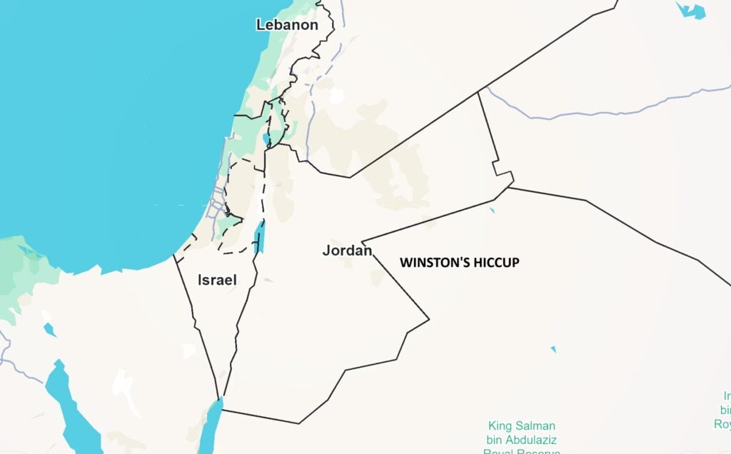
As I rounded the desert town of Azraq, an hour’s drive east of Jordan’s capital and the last major settlement before an international border carves the desert apart, I could see the ‘hiccup’ clearly on Google Maps. The Jordanian-Saudi Arabian border, which stretches for 731 kilometres from the Red Sea to a lonely tri-point with Iraq in the north, is remarkably straight. Six undeviating lines divide the two countries. Two of these lines meet a few kilometres southeast of Azraq, where a perfectly triangular wedge of Saudi Arabian land juts deep into Jordanian territory.
This wedge, or triangle of empty desert, is Winston’s Hiccup. You won’t find it signposted on any road. There are no sightseeing platforms, memorials or monuments. Just boundaries drawn in the sand. But perhaps, there should be a memorial. So we remember that this unnatural border is a lasting legacy of the colonial boundaries drawn by European statesmen in the 1920s. As legend has it, this particular bump in the border was a drunken mistake, a misplaced dash of the pen when the British drew the maps.
I wanted to see this geopolitical curiosity myself. If, that is, there was even anything to see. Because it’s borders like this, drawn hastily in boardrooms a continent away, that have defined so many of the Middle East’s conflicts since. This is a cartographical and colonial oddity — barely perceptible at a glance — but one with a remarkable backstory, tied to colonial diplomacy, desert politics and a man famous for cigars and drinking.
Watch the video here:
Table of Contents
Winston’s Hiccup: A kink in the map
Winston’s Hiccup is situated in a remote, eastern corner of Jordan. A part of the country few people visit, far from the rock-carved tombs of Petra and the Martian-domed tents of Wadi Rum. The land here is sparse, the desert a dark sheen of black basalt rocks, the remnants of volcanic lava flows that scarred the earth millennia ago. It’s here, in a harsh landscape, that the Middle East’s colonial history becomes stubbornly visible.
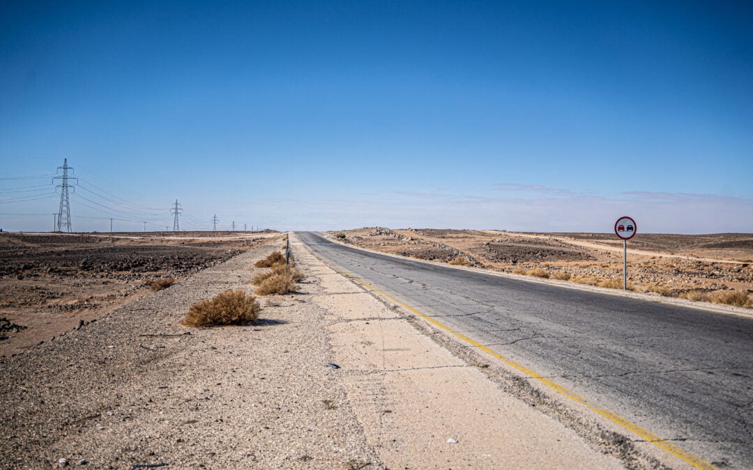
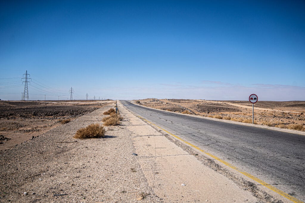
The sun climbed high as I drove Highway 30, a new, dual-lane carriageway that cuts through the desert, towards the Al-Omari border crossing separating Jordan and Saudi Arabia. The crossing sits on the northern side of the triangular wedge of border that forms the hiccup itself, one of the few official overland routes between the two nations. This part of Jordan feels like the end of a map, and in a sense, it is. If you trace the entire border, you’ll notice that most of it runs in a dead-straight line — textbook colonial geometry. But then, near the top of that line, there’s a sudden, triangular dent, cutting into Jordan. That’s the hiccup. It looks almost accidental, a tremor in the wrist, a slip of the pen.
The story goes that during the 1921 Cairo Conference, Winston Churchill, then Colonial Secretary, had a hand in drawing the borders of modern-day Jordan. Supposedly, while demarcating what would become the boundary between the Emirate of Transjordan (then a British protectorate) and the Kingdom of Nejd (now part of Saudi Arabia), Churchill made an accidental squiggle, perhaps after a liquid lunch (he was rather renowned for his somewhat ‘impressive’ drinking habits, after all).
That squiggle is now preserved as a triangular dent into Jordan’s otherwise straight eastern border. It’s been nicknamed ‘Winston’s Hiccup’ — part myth, part bureaucratic hangover, but fully visible on the map.
Read more: The King’s Highway: Driving the World’s Oldest Road
Why go to Winston’s Hiccup?
I’m drawn to places where history hasn’t been tidied up. Where the consequences of decisions made far away are still visible on the ground. Borderlands, in particular, reveal the mess of nation-making — the contradictions, the compromises, the impositions.
Winston’s Hiccup fascinated me not only because of its odd name or alleged origin story but because of what it represents. It’s a living reminder of how the modern Middle East was carved into shape after the collapse of the Ottoman Empire. The post-First World War settlements — including the Sykes-Picot Agreement and the decisions made at the Cairo Conference — were exercises in imperial cartography, drawing straight lines across desert expanses, often ignoring local realities.
The hiccup, though small in geographical terms, is a striking symbol of that larger project. It’s a wrinkle in an otherwise clean colonial line. A spatial footnote that says imperialists make mistakes and won’t try to correct them.
There are no official signs marking the border distortion. Without a map, you’d never know it was there. Most of the terrain around it is off-limits or difficult to access without a 4×4 vehicle and good local knowledge of the desert. The border itself is closed to casual travellers; the nearest crossing point, Al-Omari, is a formal checkpoint primarily used by freight lorries and diplomatic vehicles. With no Saudi Arabian visa and a Jordanian two-wheel drive hire car, my plan wasn’t to reach the hiccup itself — which lies across rough desert terrain without direct road access — but to get as close as practically possible, without being detained by border guards.
Using GPS and satellite imagery, I had plotted a route along the highway heading southeast from Azraq, aiming to reach the point where the road runs closest to the bend. The digital map showed the border line lurching inward before righting itself again. The hiccup is literally just a line on the map. There’s little to see in the physical sense, but I found a spot a few kilometres north of the border crossing, where I pulled over on the shoulder and stepped out.
Somewhere beyond the haze, behind that line in the basalt earth, was the hiccup — a quirk in the border that, by most accounts, shouldn’t be there. I could almost imagine Churchill, hunched over a map in Cairo, his pen slipping slightly after a few whiskies, and nobody correcting it. Whether it’s true or not, we’ll never know. What we do know is that the border was drawn by European statesmen or civil servants in some distant bureaucratic office, far from these empty deserts.
Standing there, squinting into the sun with nothing but desert in every direction, it was difficult to believe that a few seconds of inattention in a far-off colonial office had produced a permanent dent in the shape of two nations. But that’s exactly what happened. And even if I couldn’t walk up and touch it, just being near it — on that lonely, sunburned road — made it feel strangely real.

Read more: The Hejaz Railway: A Plan to Unite the Middle East by Train
Why does the Hiccup matter?
There’s something distinctly unyielding about this landscape. It’s not the shifting, cinematic dunes of Wadi Rum, but a more rugged, post-volcanic sort of terrain. It makes the idea of drawing borders here seem absurd. How do you claim and govern a land that looks like this? That question, in a way, haunted the colonial powers a century ago. Their answer was to draw lines, straight lines dissecting what they perceived to be pure emptiness.
At first glance, the hiccup might seem trivial. It’s not militarily strategic. There’s no natural resource hidden within its triangle. It serves no obvious purpose, but it draws attention to the arbitrary nature of so many modern borders, particularly here in the Middle East.
The borders of Jordan, Iraq, Syria, and Saudi Arabia were drawn during a period when Britain and France were dividing up former Ottoman lands into spheres of influence. The needs and desires of local populations were secondary to imperial convenience. Maps were redrawn in London, Cairo and Paris — far from the desert they claimed to understand. In that context, Winston’s Hiccup isn’t just a geographical oddity. It’s a reminder of how power operated. How foreign hands shaped the Middle East.
Jordan’s very shape and existence are the product of those years. The hiccup, though minor in territorial terms, is one of the few moments where the artificiality of the whole project becomes cartoonishly visible. It’s the border’s version of a typo — a mistake that, once printed, could not be undone.
While this section of the border is peaceful, it wasn’t so elsewhere, where people like the Kurds were divided by new national boundaries when the Ottoman Empire fell, and continue to be the largest people in the world without a nation state. Agreements like Sykes-Picot created artificial, unstable countries, creating enduring tension, conflicts and instability, leading to modern wars in Iraq, Syria, Lebanon, Israel and Palestine.
Winston’s Hiccup is a microcosm of this, and like many colonial legacies, it endures. The borders are still there. The tension over those borders still exists. And while Jordan and Saudi Arabia have since agreed to other territorial adjustments, the hiccup remains as a reminder of the colonial pens that shaped the region.
Read more: Amman: A Culinary Tour Through Political History
Leaving the line
I didn’t linger long. The sun was relentless. I took a few photos — though there wasn’t much to photograph — and marked the point on my phone. Driving back toward Azraq, I found myself thinking less about Churchill and more about the people who live in the shadow of these lines — Bedouin communities, border guards, lorry drivers. For them, the map isn’t abstract. It’s paperwork, permits and restrictions. For travellers like me, it’s often a curiosity. For others, it’s a constraint.
Travelling to Winston’s Hiccup didn’t offer me a view or a landmark, but it forced me to reckon with how casually borders can be made — and how seriously they are later enforced. Modern states are built on decisions like this one: small moments of ink and ambition that become laws, fences, and sometimes battlegrounds.
If you’re in Jordan with time and an interest in the way the world was shaped, it’s worth making the detour. You won’t find much there — and that’s the point. It’s a blank patch of earth that says everything about how borders work, and why they matter.

Read more: 11 Best Things to Do in Madaba, Jordan’s Christian City
How to visit Winston’s Hiccup
Winston’s Hiccup is located 50 kilometres southeast of Azraq, an oasis town in the basalt deserts, which is itself around 100 kilometres from Amman. I took Highway 40 from Amman to Azraq, stopping off at the famed ‘Desert Castles’ which sit off the highway. From Azraq, I took Highway 35 towards the Al-Omari border crossing with Saudi Arabia, which is the best place to visualise the hiccup, if you don’t have a 4×4 vehicle and a guide to head off-road.
This is a border region, and it’s heavily militarised, but I had no trouble driving around. I wouldn’t recommend lingering too long, however. To cross into Saudi Arabia, you’ll need a visa, and typically can’t take Jordanian rental cars over the border.
I hired a car outside Amman International Airport through Monte Carlo Car Rental. There are plenty of petrol stations in Azraq, where you can also spend the night in Azraq Lodge, a beautifully restored British military hospital overlooking a Jordanian air base.

There you have it, Winston’s Hiccup! Would you visit this cartographical anomaly deep in Jordan’s eastern deserts?

Recent Comments