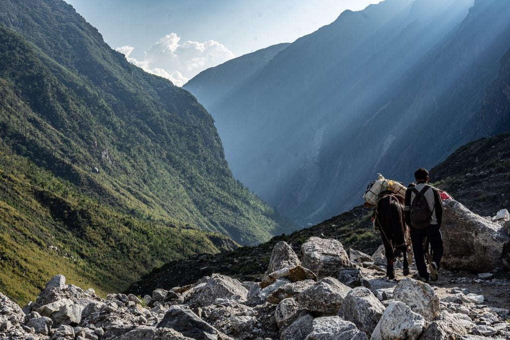
The Langtang Valley lies to the north of Khatmandu, cutting through the Himalayas as it runs alongside the long and formidable border with Tibet.
The valley rises from the lowlands and high into the mountains, passing between peaks that rise to over 7000 metres in height. It’s a spectacular place, but for the people who live here, it can be a dangerous place too, and during the 2015 earthquake that shook Nepal to its core, the Langtang Valley was utterly devastated. Entire villages were wiped off the map and hundreds were killed. The locals though, have a hardy demeanour, and 4 years after the disaster, tea houses are being rebuilt and tourists are being welcomed once again.
There are no roads, only footpaths in the valley, and I spent a week trekking through the Langtang National Park which protects the region, discovering the landscapes and meeting the locals that call this place home.
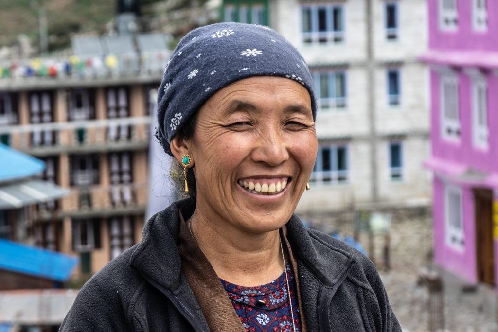
This photo essay is dedicated to both the landscapes and locals of the Langtang Valley, but most of all it’s dedicated to the resilience of the people and the hardships they endure from the environment around them, an environment that is both beautiful, and deadly.
Langtang Valley
The Langtang Valley
The Langtang Valley is found within the Himalayan range, extending from the town of Syabru Besi high into the mountains, towards Tibet. The highest peak in the park is Langtang Lirung, which rises to 7245 metres in height. Beyond the Langtang Valley, the Himalayan peaks rise even higher, with Shishapangma in Tibet being a staggering 8027 metres in height.
The highest I would be hiking though would be a meagre 4600 metres, but this would still prove to be an altitude high enough to send me delirious on more than one occasion. Being unaccustomed and unprepared for the low oxygen levels, the trek was to be a slow, uphill battle that took 4 days to reach Kyanjin Ri, at 4600 metres, and only 2 days to return again to the starting point at Syabru Besi.
Changing Mountain Scenery
Syabru Besi lies at a lower altitude, and at the start of the trek, the scenery was characterised by dense, green forests as we followed the crashing course of the river along the valley. Alongside the trees and foliage, were row upon row of wild cannabis plants growing by the hiking route, an unusual sight to see, but a plant that seemed to be particularly well suited to the climate.
The valley rises steeply in the first two days of the trek, and as we gained altitude the forests began to subside and the scenery became more and more alpine. Trees disappeared, and the snow-capped mountain peaks began to reveal themselves.
At 3800 metres, the village of Kyanjin Gompa is surrounded by high peaks and glaciers, and in moments, the weather can change from glorious sunshine to biting cold fog that leaves you lost in its icy grip.
It was at Kyanjin Gompa that we would spend two nights at altitude, and from where I would hike to the highest point of my trek. At 4600 metres, my hands would swell to the size of giants’ from the lack of pressure, and every step upwards would be a constant struggle against my own desire to be back at sea level.
Tibetan Culture in the Langtang Valley
Nepal is a diverse country, home to different communities and ethnic groups that practise different religions and have different beliefs. In the Langtang Valley, the vast majority of people are from the Tamang ethnic group, and their culture is closely linked to that of Tibet, which lies across the snow-capped mountains.
In the valley, there are pagodas, temples and shrines at every place of local importance. On the mountain tops, colourful Tibetan prayer flags flutter in the wind or are rocked by gales. The people here are Buddhists, and across the valley, I realised the importance of this religion to these people who live high in the mountains, because theirs can be a precarious existence in this tumultuous part of the world.
Dal Bhat and Yak Cheese
At higher altitudes, food can become scarce. Few things grow well at 4000 metres, and the inhospitable weather can make agriculture unpredictable. In the Langtang Valley, no meat is served at the tea houses along the trekking route, but one thing that is ubiquitous is Dal Bhat.
Dal Bhat was served almost every day of the trek, and while it can get monotonous to eat the same dish over and over again, it’s a meal that provides the fuel needed to hike. Dal Bhat is simple. It’s rice, served with lentils and other vegetables – although outside of the valley, it’s also served with meat.
Few animals survive well in the higher regions of the valley, making meat a rare commodity in the Langtang Valley. One animal that does thrive, however, is the Yak, but rather than being just a source of meat, the Yak is a much-needed source of dairy products.
In Kyanjin Gompa, at 3800 metres, the locals have a cooperative that buys Yak milk from across the Langtang Valley. At the Yak Cheese Production Centre in the village, Yak cheese is produced using a mix of traditional techniques, and modern techniques brought to Kyanjin Gompa from Switzerland by Swiss money and aid. Yak Cheese is strong in flavour and the perfect fuel for mountain hiking.
Dal Bhat Yak Cheese Yak Cheese Production Slicing Cheese A Teahouse Kitchen
Destruction and Hardship
In April 2015, Nepal was rocked by a devasting earthquake that killed thousands across the country. In the Langtang Valley, landslides and avalanches wiped out entire villages, with the worst affected being Langtang Village, where hundreds of locals and tourists were killed.
Entire villages were wiped out, and for several years, the valley was closed to tourism as the locals struggled to come to terms with their losses, and to rebuild again. Walking through the valley, four years after the natural disaster, there are still the visible ruins of villages.
Broken houses remain empty. Huge boulders rest on top of what were once tea houses, and the mountains themselves still show the haunting scars of landslides. This is a part of the world that lies at the mercy of the landscapes that surround it, and in April 2015, the natural forces at work revealed how destructive they can be.
A temporary shelter Ruined houses Langtang Village Today Langtang Memorial
Rebuilding and Resilience
Many people moved away from Langtang in the years following the earthquake, but many more stayed too. Some didn’t have a choice, others wanted to rebuild. While some villages remain completely abandoned and in locations that are deemed too dangerous to inhabit, others are now heading back to normality.
Langtang Village, although utterly destroyed in the earthquake, is now being rebuilt, and it’s once again becoming a popular stop on the trek. A monument at the entrance to the village though, lists the names of all those who were killed in the natural disaster.
Along the trails that lead through the valley, local workers were continually transporting goods and equipment uphill. Sacks of concrete were strapped to the backs of mules, while huge planks of timber were simply carried up by the locals. It is clear that Langtang will soon again be filled with hikers and trekkers, but that has only been made possible by the stoic resilience of the people that live here and stayed in the valley despite all that the mountains threw at them.
Guides and Porters
I was invited to visit the Langtang Valley by the Nepal Tourism Board, as part of their Himalayan Travel Mart event, which aims to promote Nepal and the wider Himalayan region to the rest of the world. In particular, they wanted the world to know that the Langtang Valley is once again, very much open for business.
As part of the trip, the tourism board hired porters to help carry our trekking group’s gear up the valley, as well as our incredible guide Ashok, who encouraged us all up the mountains. The team aren’t from Langtang, but like many in Nepal, they also showed the same stoicism and resilience when it came to life, and without them, the trek would have been much, much more difficult.
The Langtang Family Our Porters Porters hard at work!
All Words and Photos by Richard Collett
Disclaimer: The Langtang Valley Trek was provided by the Nepal Tourism Board, as part of HTM 2019, however, all opinions expressed in this article are, as always, my own!


Recent Comments